|
|
 |
Geographic Programming and Analysis:
- Visual Maps with Business Data
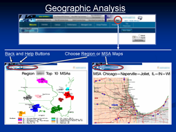
Design of an automated business data mapping system
- Includes all business regions, districts, territories and MSA's (metropolitan areas)
- Interactive user reports, with location (or any other data) chosen.
- Overlays and markers for business data
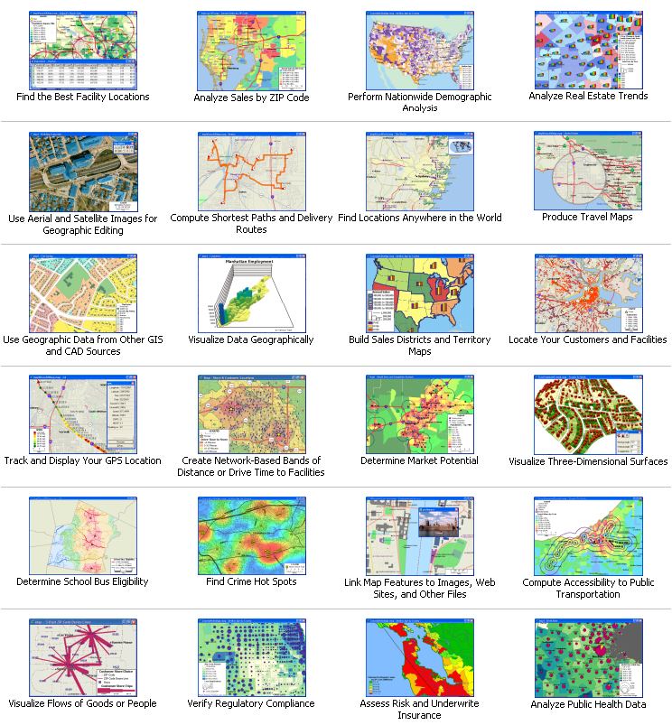
I can also produce a wide variety of other geographic reports:
|